
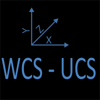
Coordinate System
AutoCAD WCS and UCS
There are two basic types of coordinate systems in AutoCAD. The World Coordinate System (WCS) is the default coordinate system. If desired, the origin of the coordinate system and the orientation of the coordinate system can be changed to any location the user defines. When the coordinate system is changed from the WCS, it is called the User Coordinate System (UCS).
Get the Top 35 AutoCAD Commands for FREE
For some commands, the location of the UCS is important and changing it will make executing a command easier. To change the UCS, enter UCS at the command prompt and select a new origin (0,0) for the UCS. To change the UCS back to the WCS, enter UCS and the command prompt and select W for World Coordinate System, and the origin will be restored to the original (0,0) when the drawing was initially created.
Coordinate System
Understand WCS and UCS in AutoCAD—learn when and how to switch coordinate systems for precise drafting

Copy vs CopyBase
Learn the difference between the COPY and COPYBASE commands in AutoCAD. Discover how base points and the clipboard affect how objects are copied within or between drawings.
Dynamic Input
Dynamic Input shows distances, angles, and prompts at the cursor in AutoCAD. Learn how it works, when it speeds up drafting, and when turning it off leads to cleaner, more controlled workflows.

Philosophy of Layer Management
Discover why layers are the backbone of AutoCAD. Learn how discipline standards, visibility control, and plotting hierarchy bring clarity to AutoCAD.

Selecting Drawing Objects
Three Methods to Select AutoCAD Objects: Window, Crossing, Direct Selection. Learn which is the best method to use every time you select objects.

Terminology
Learn the terminology used in AutoCAD. Become an expert when talking about AutoCAD to your clients and coworkers.